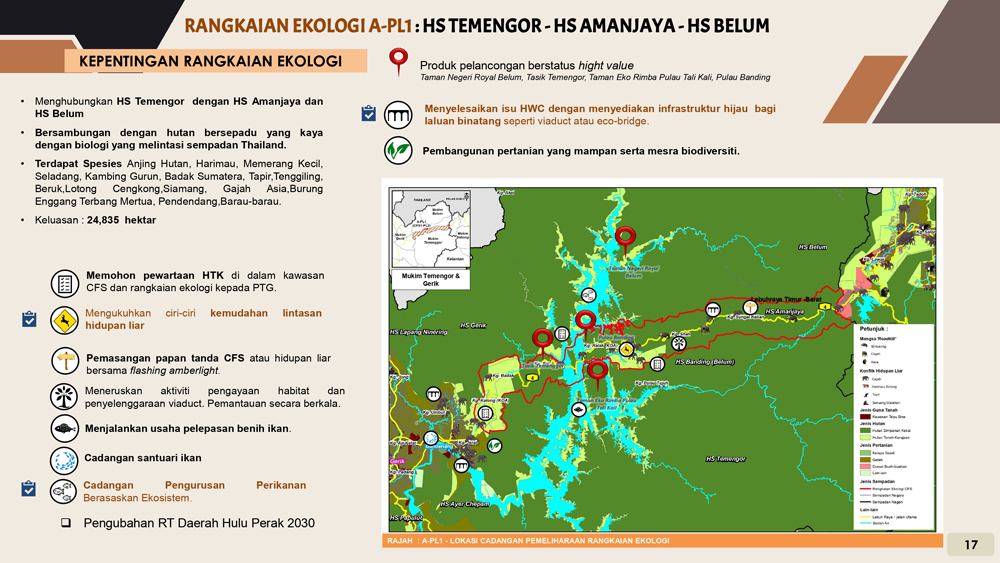
A-PL1
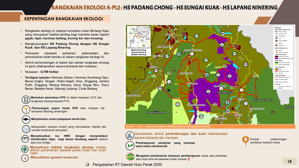
A-PL2
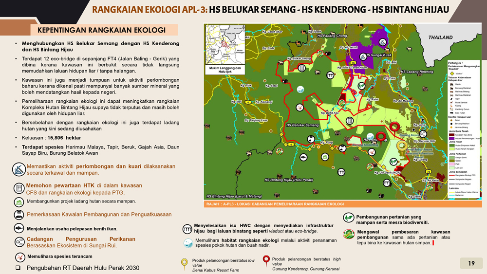
A-PL3
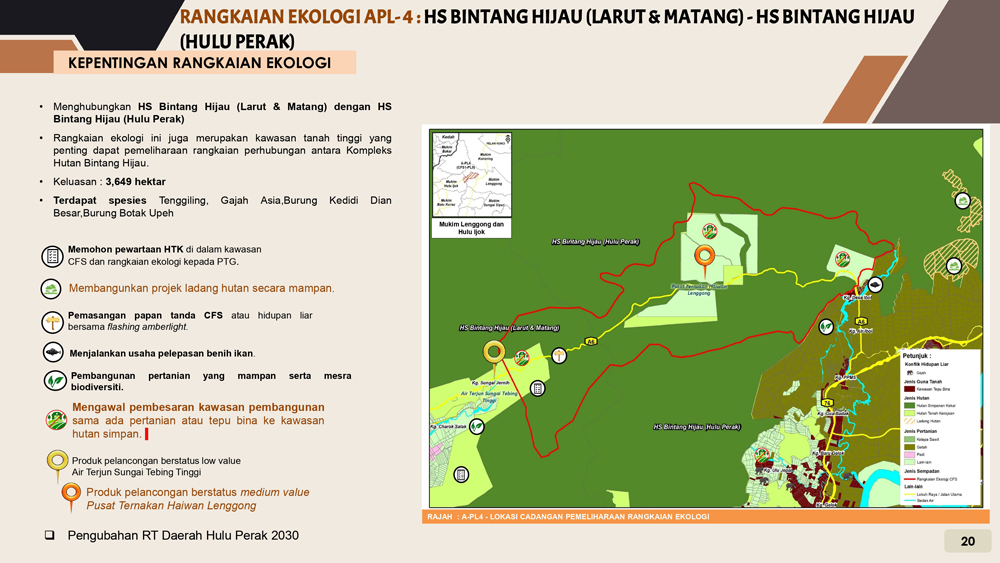
A-PL4
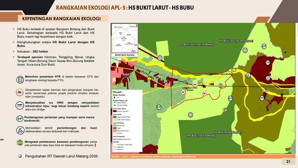
A-PL5
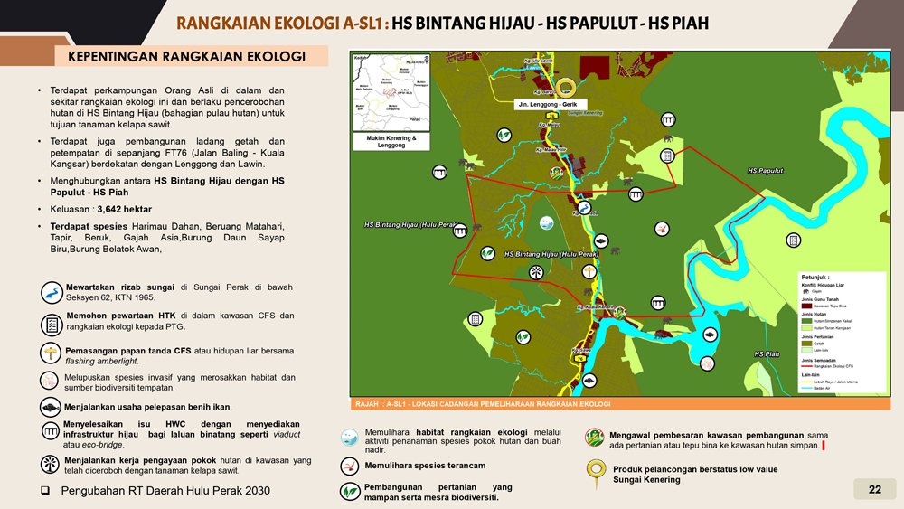
A-SL1
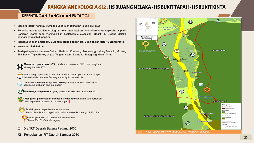
A-SL2
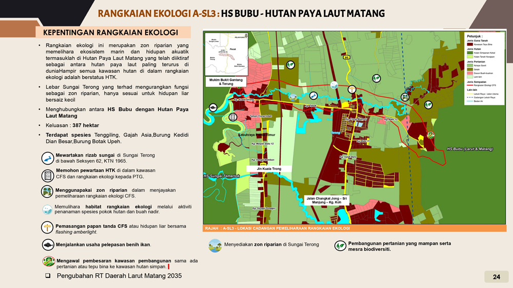
A-SL3
What is CFS and the Importance of the CFS Area
CFS consists of four main forest complexes in Peninsular Malaysia. The CFS area is 5.3 million hectares, covering eight states: Perak, Pahang, Johor, Terengganu, Selangor, Kelantan, Kedah and Negeri Sembilan.
CFS also provides protected habitats for endangered species such as Leopards, Sun Bears, Tapirs, Asian Elephants and others. As part of the biodiversity-rich Sundaland region, it also has a number of other species of wildlife, plants and microorganisms identified for their contribution to our country's mega-biodiversity status.
As one of the important natural areas in Malaysia, CFS also provides irreplaceable ecosystem services such as 90% of the water supply for the country's population, climate regulation, soil protection and reducing the risk of flooding and others. This also provides timber and non-timber resources that contribute to the national economy as well as support the communities living in the area.
Main Network

Key Links in the CFS are identified as linear corridors, which connect two separated forests to re-establish their connectivity for a continuous link in the Central Forest Spine.
These connections allow wildlife, genetic resources, and ecological functions to move freely between the two areas. Most of these areas are located between important forest blocks, in narrow areas that are usually untouched by urban development. They require major interventions such as land acquisition and flyover construction instead of normal highways.
Secondary Network

Secondary relationships are known as complementary relationships, where they are established on more degraded lands that need to maintain a degree of connectivity between forest areas.
This relationship takes the form of a stepping stone that replicates a riparian corridor - a small patch of restored vegetation that filters and allows the movement of small (and larger) mammals, birds and insects between landscapes.